u/WearierMoss4664

Image 1 — The United States of America
Image 2 — The United States of America
Image 3 — The United States of America
Image 4 — The United States of America
Image 5 — The United States of America
Image 6 — The United States of America
Image 7 — The United States of America
Image 8 — The United States of America
Image 9 — The United States of America
Image 10 — The United States of America
Image 11 — The United States of America
Image 12 — The United States of America
Image 13 — The United States of America
Image 14 — The United States of America

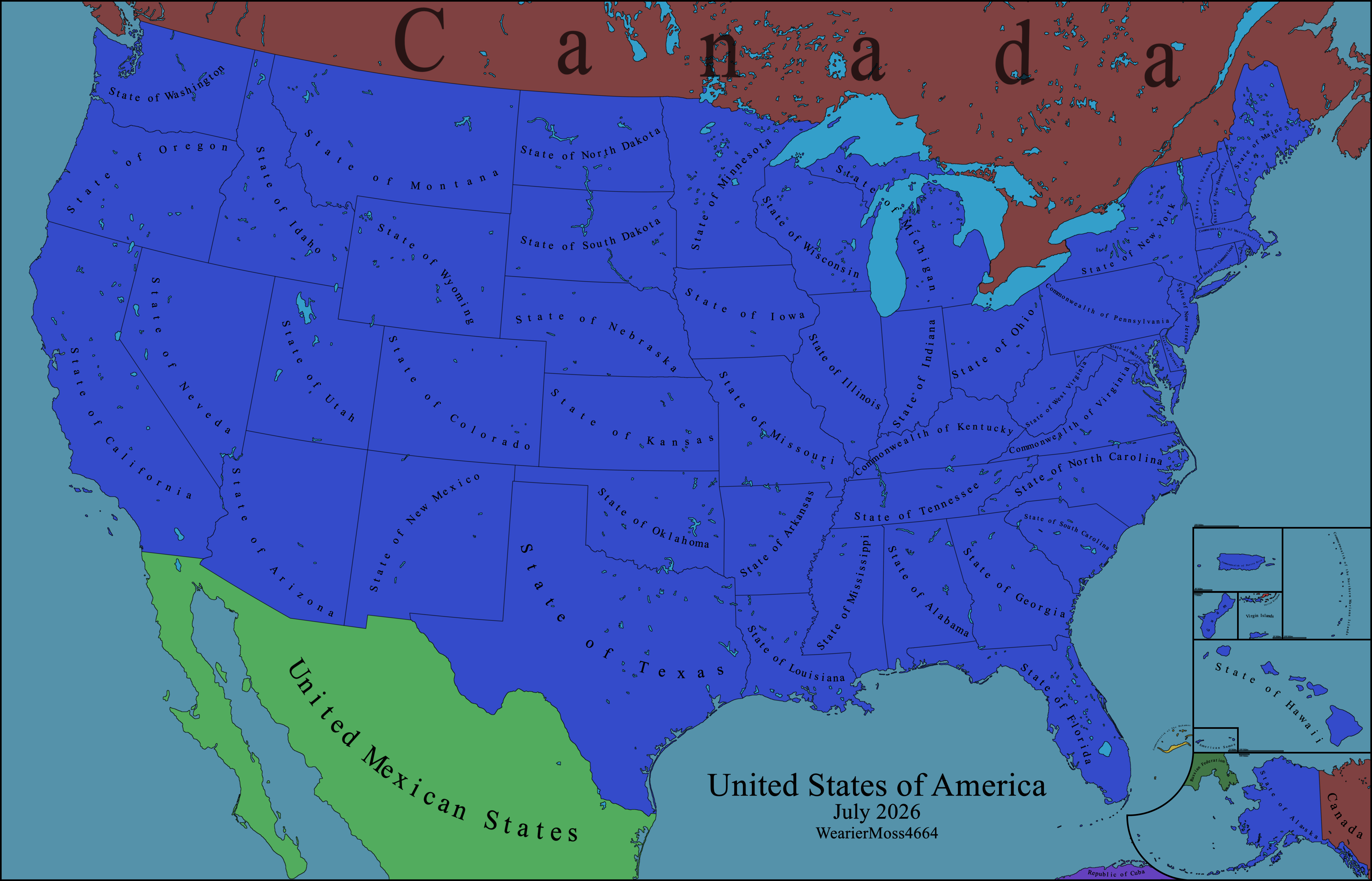
The United States of America

The United States of America, Happy 250th anniversary.

The states, commonwealths, inhabited territories, and federal district of the United States of America.

I'm quite pleased with how this turned out, 8000x5000 seemed to be the right size to display everything. Feedback is welcome.

Full resolution images, extras, and related files can be found in the Github linked in my bio.
Full Resolution Map

u/WearierMoss4664 — 1 day ago

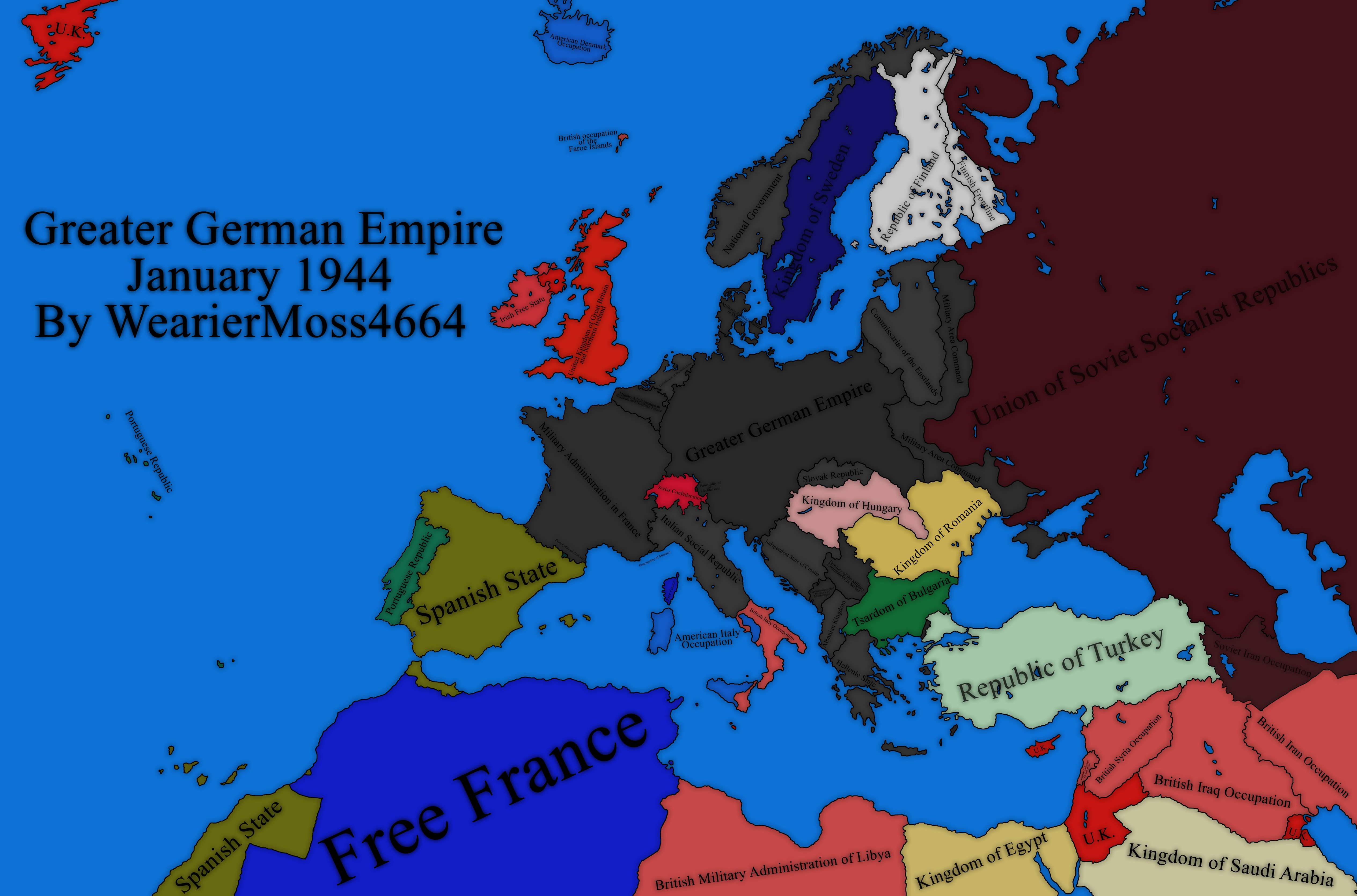
Greater German Empire with better readability.

The Greater German Empire January 1944, now with close-ups, so you can actually read it.

Feedback is welcome.

I know this post doesn't fix the black text over dark backgrounds, I've heard the feedback and will keep that in mind for future maps! I honestly don't know if white text would totally fix the issue because image compression totally ruins any readability. I promise the uncompressed file looks way better.

The Corrections and Notes section, full resolution images, and related files can be found in the Github links below or the link in my bio.

Full Resolution Map

Greater German Empire Files

u/WearierMoss4664 — 1 month ago

The Greater German Empire January 1944

The Greater German Empire January 1944.

This is another old one, from 2022. I make a point not to go back and fix my maps, and this one definitely has some issues, mainly regarding naming.

Corrections

  1. "Greater German Empire" should be "Greater German Realm"

  2. "National Government" should be "Realm's Commissariat for the Occupied Norwegian Territories".

  3. "Commissariat of The Netherlands" should be "Realm's Commissariat for the Dutch Territories".

  4. "Commissariat of the Eastlands" should be "Realm's Commissariat of Eastland".

  5. The Commissariat of Eastland itself was a sub-division of “Realm’s Ministry for the Occupied Eastern Territories”. I’m unsure if Eastland should technically be named that.

  6. The independence of the “Independent State of Croatia” is debatable at best, but I think it should probably be a different color to signify not being directly administered by German officials.

Notes

  1. The Commissariat of Norway was co-ruled by a native regime called "National Government", however the Commissariat held de-facto total control over all administration.

  2. Inside Eastland there is a subdivision called “General District White Ruthenia”, White Ruthenia was co-ruled by a native regime called “Belarusian Central Council”. Is that worthy of putting on the map (no), I'll let you decide.

  3. “Territory of the Military Commander in Serbia” was co-ruled by a nativeregime called “Government of National Salvation”, however the Military Commander held de-facto total control over all administration.

u/WearierMoss4664 — 1 month ago

The Greater German Empire January 1944

The Greater German Empire January 1944.

This is another old one, from 2022. I make a point not to go back and fix my maps, and this one definitely has some issues, mainly regarding naming.

Corrections

  1. "Greater German Empire" should be "Greater German Realm"

  2. "National Government" should be "Realm's Commissariat for the Occupied Norwegian Territories".

  3. "Commissariat of The Netherlands" should be "Realm's Commissariat for the Dutch Territories".

  4. "Commissariat of the Eastlands" should be "Realm's Commissariat of Eastland".

  5. The Commissariat of Eastland itself was a sub-division of “Realm’s Ministry for the Occupied Eastern Territories”. I’m unsure if Eastland should technically be named that.

  6. The independence of the “Independent State of Croatia” is debatable at best, but I think it should probably be a different color to signify not being directly administered by German officials.

Notes

  1. The Commissariat of Norway was co-ruled by a native regime called "National Government", however the Commissariat held de-facto total control over all administration.

  2. Inside Eastland there is a subdivision called “General District White Ruthenia”, White Ruthenia was co-ruled by a native regime called “Belarusian Central Council”. Is that worthy of putting on the map (no), I'll let you decide.

  3. “Territory of the Military Commander in Serbia” was co-ruled by a nativeregime called “Government of National Salvation”, however the Military Commander held de-facto total control over all administration.

u/WearierMoss4664 — 1 month ago
▲ 11 r/MapPorn

The Middle East Circa. 1800

This is an older map of mine, from around 2021, so I don't have all of the resources I used to make it. I think I got it pretty accurate, though information on borders for this region at this time is hard to find.

If anyone knows a method I could use to share the related files, please tell me. Mega links seem to be blacklisted, so I can't use that.

u/WearierMoss4664 — 1 month ago